This morning (6th February 2025), climate scientists confirmed what many feared—January 2025 has officially been recorded as the hottest January in history. According to the EU’s Copernicus Climate Change Service, global temperatures were 1.75°C above preindustrial levels, extending an unprecedented streak of record-breaking heat. January 2025 was expected to be slightly cooler than January 2024 because of a shift away from a natural weather pattern in the Pacific known as El Niño; instead, its rise has left climate scientists puzzled.
As extreme weather events become more frequent and severe, space-based technology plays an increasingly pivotal role in safeguarding our planet. The ability to track climate shifts, predict disasters, and monitor environmental damage in real time has never been more essential.
A New Era of Climate Monitoring from Space
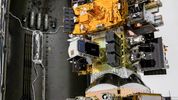
Space-based Earth observation has undergone a technological revolution, driven by advancements in Synthetic Aperture Radar (SAR) satellites. Unlike optical satellites, which are limited by daylight and cloud cover, SAR technology can provide high-resolution imaging, 24/7, regardless of weather conditions.
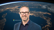
In a recent episode of the Generation Space podcast, Steve Young, Head of Satellite Missions at ICEYE, and Mark Boggett, CEO of Seraphim, discussed how SAR satellites are transforming our ability to respond to climate change and natural disasters. From tracking floods, wildfires, and deforestation to measuring thermal emissions from cities and industrial sites, these satellites provided by ICEYE offer an unfiltered, real-time view of Earth’s changing landscape.
The applications of satellite data in environmental protection are vast:
- Wildfire and Flood Response: SAR satellites can see through smoke, clouds, and darkness, allowing emergency services to track the spread of wildfires and floods in real time.
- Deforestation Detection: Brazil has deployed SAR satellites specifically to monitor illegal deforestation of the Amazon, a critical move in tackling carbon emissions from land-use change.
- Climate Accountability: Governments, corporations, and policymakers can no longer ignore or manipulate environmental data—the truth is in the satellite images.
- Insurance and Disaster Recovery: The insurance industry is leveraging SAR data to assess real-time damage after floods, hurricanes, and wildfires, allowing for faster claims processing and response efforts.
This real-time Earth intelligence is closing a critical gap in our ability to act on climate data, moving from prediction to precision-driven intervention.
Geopolitics, Security, and the Role of Private Investment
The commercial space sector is driving these innovations at an unprecedented pace, with private investment playing a crucial role. Seraphim, the global leader in space tech investment, is funding the next wave of Earth observation technology, supporting companies like ICEYE in deploying constellations of SAR satellites that provide global-scale intelligence.
But climate monitoring is only one part of the equation. The increasing instability in global geopolitics has fuelled a surge in defence and security spending, with governments turning to space technology to protect national interests. As Mark Boggett noted, “All satellites are inherently dual-use—they serve both commercial and defence applications. What we’re seeing is defence dollars accelerating the capabilities of satellites, which ultimately benefits both sectors.”
This infusion of capital from security-driven investments is rapidly advancing SAR capabilities, meaning climate monitoring efforts are benefitting from the same technological breakthroughs as defence operations.
The Future of Space-Driven Sustainability
The deployment of AI-driven, real-time satellite intelligence is reshaping how we protect and manage Earth’s resources. From precision agriculture and water management to tracking illegal fishing and industrial emissions, the ability to monitor every square kilometre of the planet in near real-time is revolutionising sustainability efforts.
However, awareness remains a barrier. Many industries still don’t realise the power of satellite data and its unique capabilities. The challenge now is to educate businesses, governments, and global institutions about how they can leverage these insights to drive meaningful action.
With global temperatures reaching new records and extreme weather events becoming the new norm, space technology is no longer a luxury—it is a necessity.
Companies like ICEYE are leading the charge, proving that climate intelligence from space is not just about observation—it’s about action. In a world where every fraction of a degree matters, the ability to see, predict, and respond to climate change in real time is one of the most powerful tools humanity has. The space sector is no longer just about reaching new frontiers—it’s about safeguarding our planet.
To listen to the episode discussed in the article, please click the link here - https://seraphim.vc/generation-space/podcast/the-intelligent-age-safeguarding-the-planet-steve-young-iceye-and-mark-boggett-seraphim/
 unknownx500